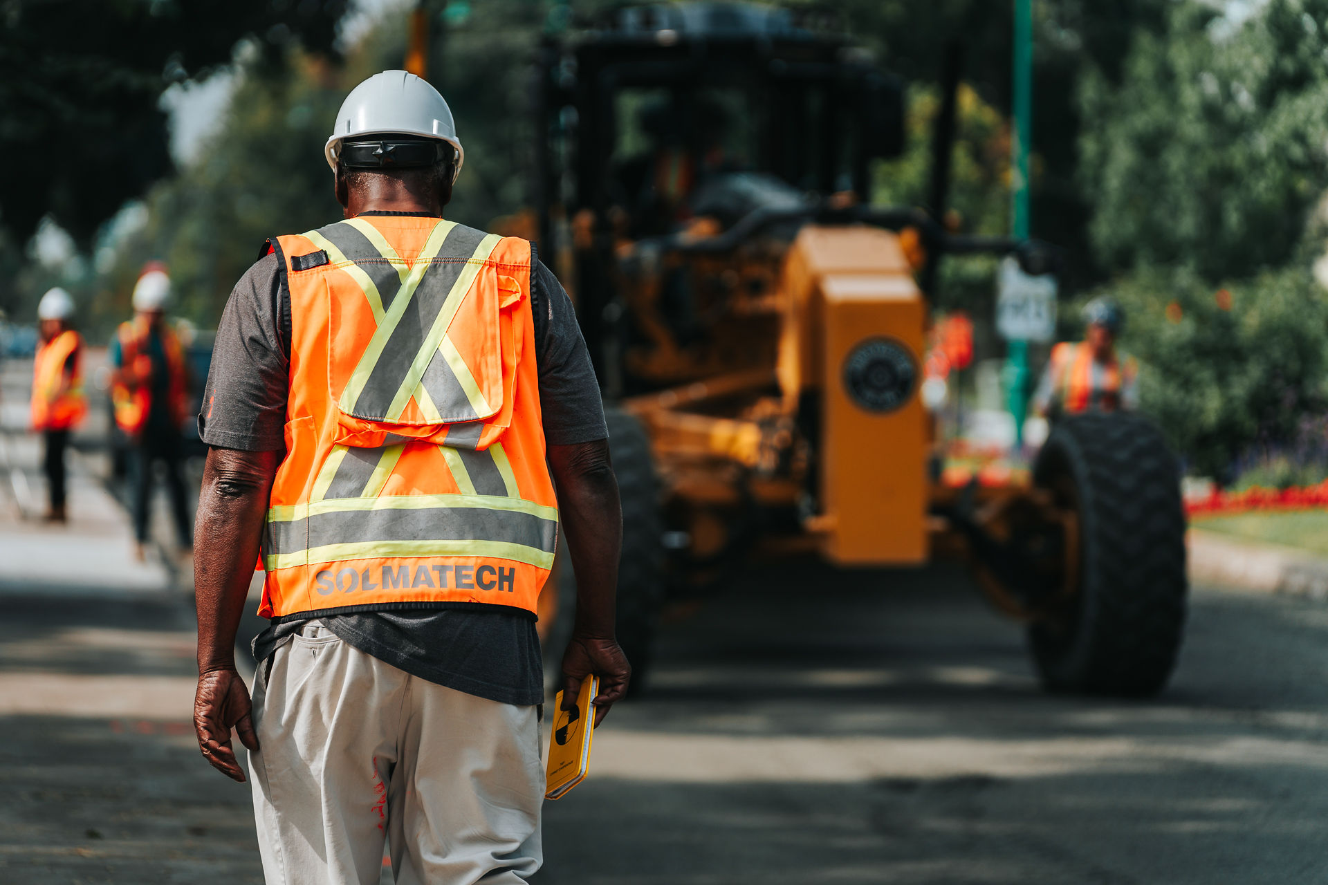
Environment Our environmental specialists evaluate the presence of contamination sources on the land under investigation, quantify their effects on the quality of surrounding resources including (soil, water, air, wildlife and vegetation), and propose measures to mitigate or entirely eliminate them. Solmatech’s environmental division offers comprehensive services and expertise encompassing soil analysis, environmental rehabilitation, and decontamination of contaminated sites. This includes monitoring excavated materials, managing groundwater and surface water, carrying out toxicological assessments, and performing site characterization. Our staff is equipped to oversee and coordinate the segregation of soil and waste materials according to contamination levels, validate the characteristics of excavated soils or materials, perform strategic sampling at control points, excavation walls, or bases at designated intervals, safeguard particular site features, and regulate the environmental quality of groundwater or water accumulating in excavation pits in compliance with discharge standards. Solmatech Aadded Vvalue Environment
- We approach each project with a solutions-oriented mindset; we strive to fully understand the challenges and collaborate closely with your team to anticipate obstacles.
- We own our drilling rigs, which enables us to operate independently and maintain control over our schedules.
- We are committed to working diligently while fostering a positive work environment, recognizing that engagement and motivation are essential to our success.
- We prioritize transparency by anticipating potential issues in your projects and providing effective strategies to address your specific needs.
Supporting you throughout every stage of the process Preliminary studies:
- Environmental site assessment (ESA) - Phase I
- Ecological characterization (delineation of terrestrial, wetland, and aquatic environments)
Preparatory studies:
- Environmental site assessment (ESA) - Phases II to IV
- Tank removal supervision
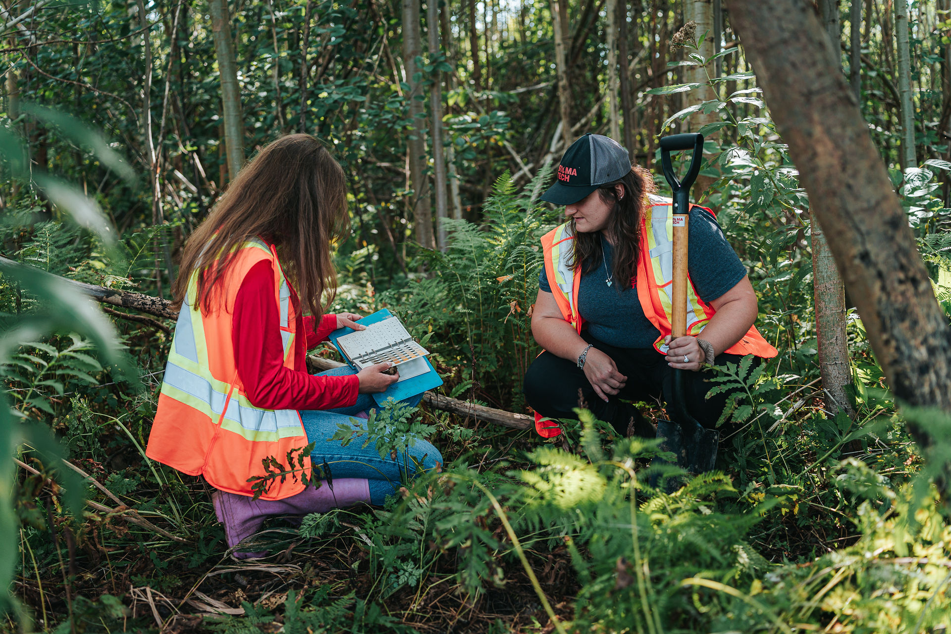
- Soils and water characterization
- Toxicological and ecotoxicological risk assessment
- Toxicology consulting
- Groundwater contamination monitoring
- Plans and specifications (environmental technical clause)
- Cost estimation for site rehabilitation
Project implementation:
- Environmental monitoring throughout contaminated soil management
- Traceability of excavated contaminated soils
- In-situ remediation of affected sites
- Sampling and site characterization
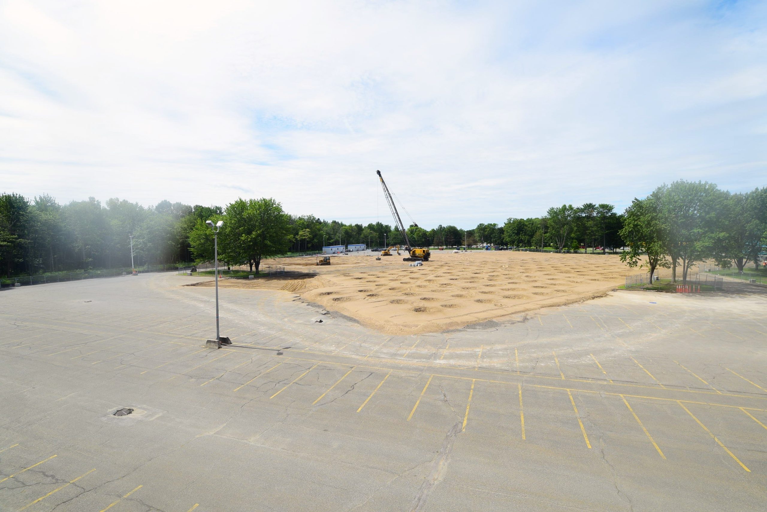
Contaminated soil traceability According to the Regulation respecting the traceability of excavated contaminated soils, authorities require the use of Traces Québec, a traceability software that enables the tracking of contaminated soils from their source to their final destination. For further information on the regulation’s impact on contractors, please refer to our article here! We recognize the challenges and complexities associated with the Traces Québec software and possess the expertise to optimize soil disposal rates for your projects. Solmatech's approach to traceability prioritizes simplicity and efficiency to best serve our clients. We offer support throughout the following stages of your project:
- Configuration and preparation of the Traces Québec software
- Appointment of a qualified technician to manage traceability using the Traces Québec software
- Certification of your project within the Traces Québec system (for projects exceeding 200 metric tons)
As of now, our technical teams have successfully tracked nearly 2 000 000 tons of soil using this software, supported by over 200 technicians deployed across Quebec. Geomatics The success of planning, construction, management, and maintenance of your projects depends on reliable spatial data. Our geomatics services deliver a clear and precise representation of on-site conditions. Utilizing advanced equipment, including LiDAR and the BathyCat Catamaran, we ensure high-quality data processing capabilities. Our services Drone services Offered services:
- Building and infrastructure inspections
- Construction site monitoring
- Topographic surveying and mapping
- Remote sensing and thermographic analysis
- 3D modeling and as-built planning
- Design and volumetric calculations
Areas of application:
- Civil engineering and construction (inspections, volume calculations)
- Environment (agriculture, wetlands)
- Geotechnics (bank erosion, slope stability)
- Quarry operations
- Soil deposit management
- Landfill site management
- Other areas of application
LiDAR services LiDAR uses lasers to measure the position of objects, enabling high-precision topographic surveys for detailed reconstruction or inspection. Offered services: This innovative technology provides extremely accurate and detailed data and information for:
- Environmental and geotechnical reports
- Vegetation and building surveys
Areas of application:
- Topographic sSurveying This process collects altitude data in dense vegetation areas, enabling the extraction of both Digital Elevation Model (DEM) and Digital Surface Model (DSM) data.
- Infrastructure reconstruction The DJI L1 drone equipped with a LiDAR camera proves highly suitable for reconstructing detailed structures such as power lines, pipelines, and gas pipelines. This technology reduces the need for human operations.
- Forestry Owing to the multi-echo capability of the DJI L1 drone with LiDAR camera, altitude data stratified within dense forest areas can be efficiently generated and extracted into DEMs and DSMs.
Operational overview
- The LiDAR camera emits a laser pulse toward the surface. The laser reflects off the surface and returns to the sensor, which measures the time taken for the laser to travel and calculates the distance between the LiDAR camera and the surface.
- This process captures between 18 ,500 to 750 ,000 points per second.
Bathymetry services Bathymetry involves measuring ocean depths and relief to determine the topography of the seabed. This technique allows for the mapping of water columns depths per second. Areas of application:
- This solution serves as an ideal option for inaccessible areas that restrict boat use.
The BathyCat Catamaran The BathyCat functions as a portable, unmanned study catamaran designed to conduct bathymetric surveys with a single-beam echo sounder while the operator remains safely onshore.